Our History
ESAN GEOGRAPHY
Esan land is bordered to the south by Benin City, to the south-east by Agbor, to the north and east by Etsako, to the west by River Niger. From Ewu to Benin City, the State capital, is 100 km long.
The people populate areas such as Uromi, Ewohimi, Ewatto, Igueben, Irrua, Ubiaja, Ogwa, Ebelle, Ekpon, Ewossa and Amahor, Ekpoma, Ohordua, and Ewu in central Edo State, South-South Nigeria. It has a flat landscape, lacking in rocks and mountains, and is good for agricultural purposes.
The topography of Esanland Ekpon plateau starts its rise from Ekpon and into six miles slope to Ewohimi, creating “Ekpon mini Plateau” . Ekpon is the gateway to Esanland, South East and the first of Esanland Kingdom therein as a border town, where centuries contacts with neighbors south in the Niger Delta, have influenced its Esan dialects by its earlier contacts through subsistence agriculture with the Ika speaking people of Igbanke, Oligie Igbodo etc.
Our History
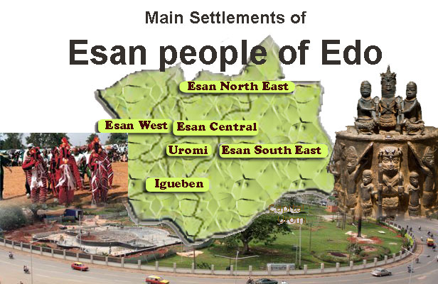
PRESENT DAY LOCAL GOVERNMENT AREAS
Esan Central L.G.A., with its headquarter in Irrua.
Esan West L.G.A., with its headquarter in Ekpoma.
Esan North-East L.G.A., with its headquarter in Uromi.
Esan South-East L.G.A., with its headquarter in Ubiaja.
Igueben L.G.A., with its headquarter in Igueben.